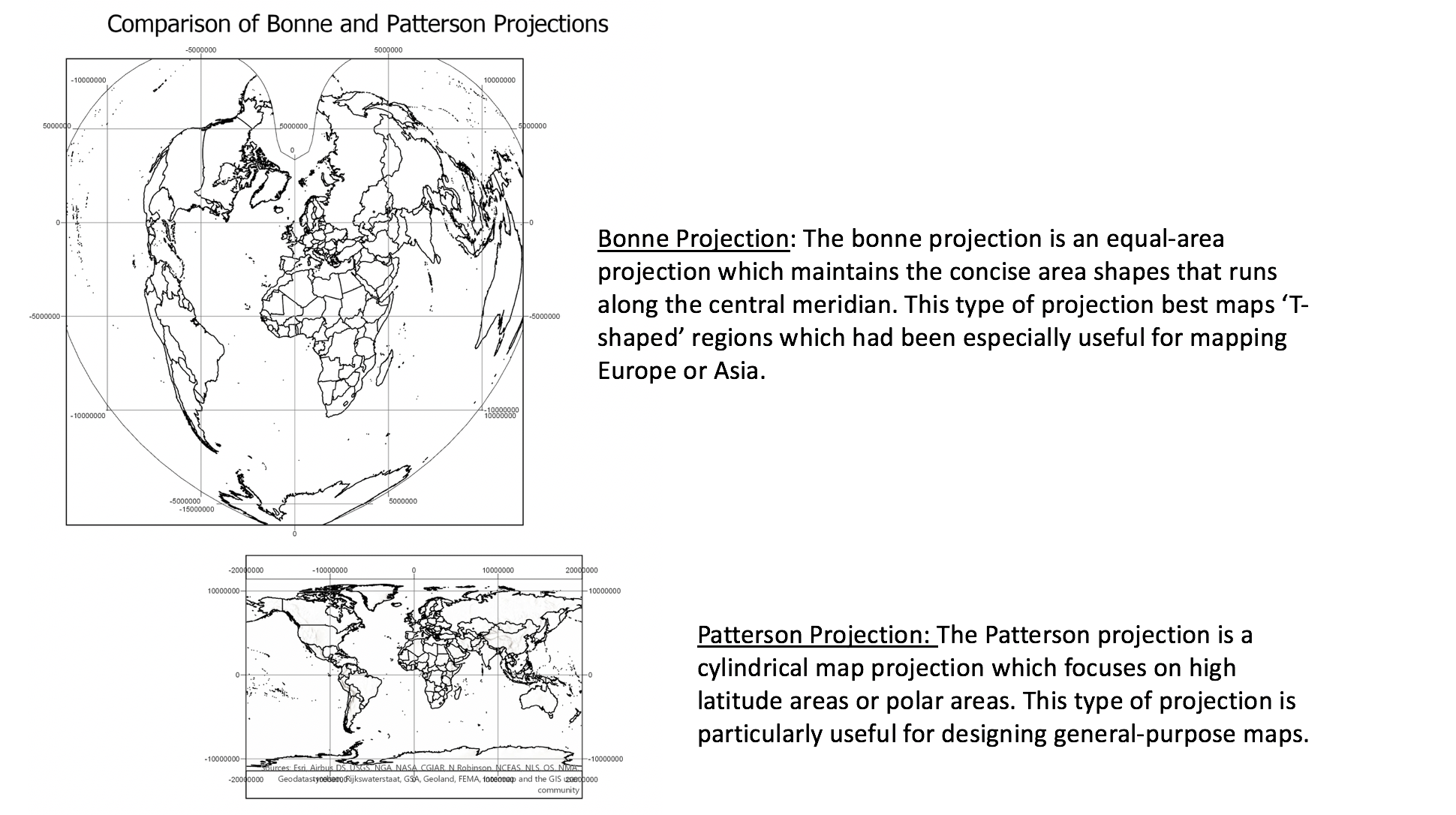
In this assignment, we were using ArcGIS to work with different projection maps and understanding what each projections represent.
Exploring How Projections differ

Welcome to Dianne’s GIS portfolio. The purpose of this portfolio is to showcase my course assignments that were created using a variety of GIS software, demonstrating concepts and theories that were explored for spatial data analysis!
In this assignment, we were using ArcGIS to work with different projection maps and understanding what each projections represent.