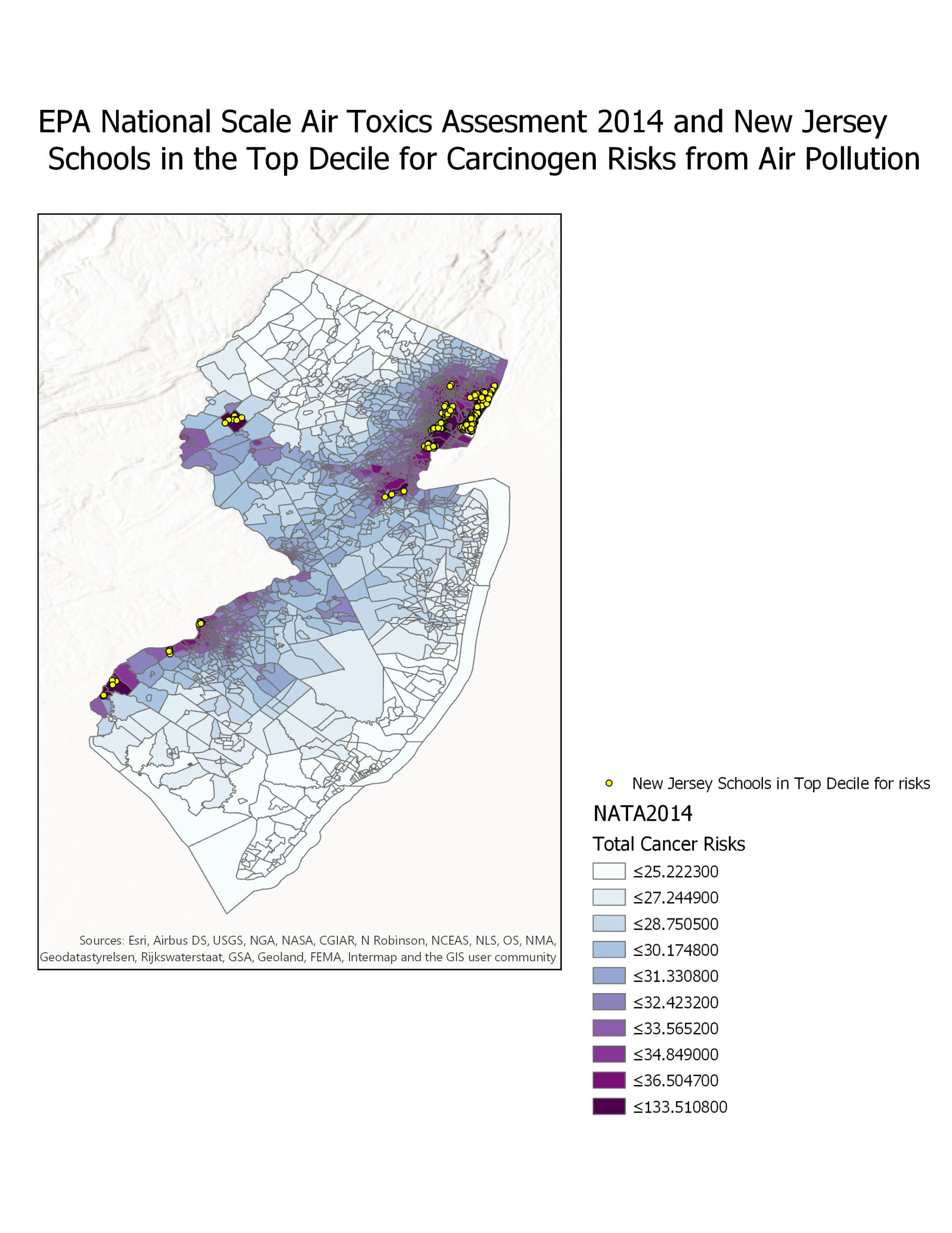
In this assignment, we explored selective mapping and display by mapping out New Jersey Schools in the top decile for Carcinogenic risk from air pollution.
Selective Mapping and Display- New Jersey Schools in Top Decile for Carcinogenic Risks

Welcome to Dianne’s GIS portfolio. The purpose of this portfolio is to showcase my course assignments that were created using a variety of GIS software, demonstrating concepts and theories that were explored for spatial data analysis!
In this assignment, we explored selective mapping and display by mapping out New Jersey Schools in the top decile for Carcinogenic risk from air pollution.