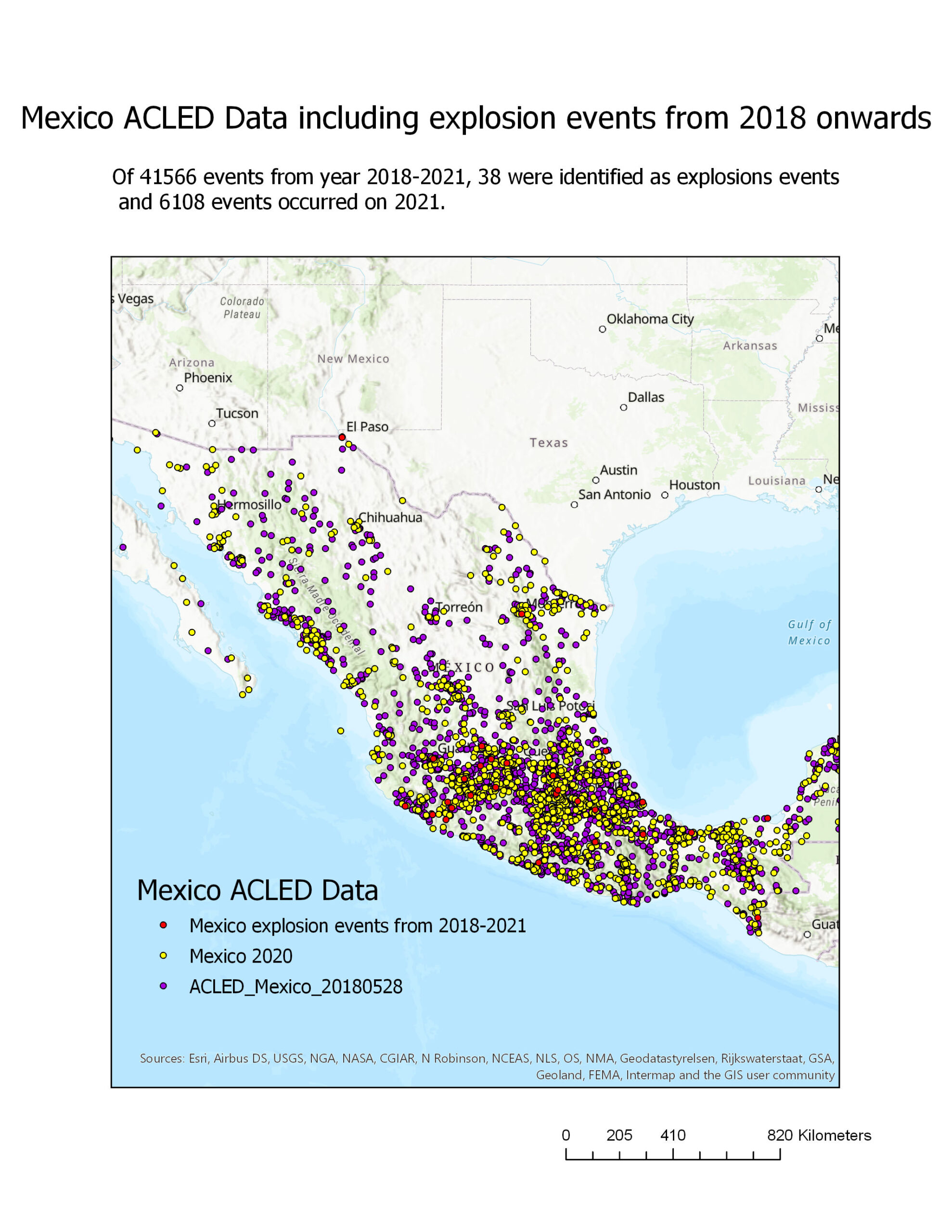
In this assignment, I was exploring Mexico’s ACLED Data and mapped the events out using ArcGIS.
Acquiring ACLED Data- Query and Selection

Welcome to Dianne’s GIS portfolio. The purpose of this portfolio is to showcase my course assignments that were created using a variety of GIS software, demonstrating concepts and theories that were explored for spatial data analysis!
In this assignment, I was exploring Mexico’s ACLED Data and mapped the events out using ArcGIS.